Live Cams
Countries
Featured Cams
Get A Cam
Live Cams
Countries
Featured Cams
Get A Cam
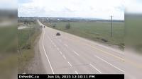
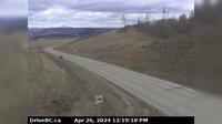
Area C › West: Hwy 19 near Hyde Creek Rd, 4.5km south of Port McNeill, looking west | Live Webcams
Webcam & Weather Report
See.cam
North America
CA
British Columbia
Area C
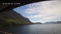
Area C › West: Hwy 19 near Hyde Creek Rd, 4.5km south of Port McNeill, looking west
Current Still
Timelapse
Daylight Still
Webcam was last updated 2 years ago
Rating
Webcam Views
Map
Discuss
See more webcams in
British Columbia
Abbotsford › North
Abbotsford › West: Hwy 1 at Clearbrook Rd, looking east
Chetwynd
Dawson Creek › East: Hwy 97 at Dangerous Goods Route, west of - looking east
Charlie Lake › South-West: Hwy 29, 29 km west of Ft. St. John, looking southwest
Whistler Creekside › East: Hwy 99, in Whistler at Lake Placid Rd, looking east
Area A › North: Hwy 95, near Quinn Creek, about 31 km north of Brisco, looking north
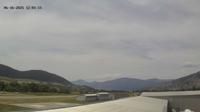
Columbia-Shuswap Regional District › East: , Hwy , about km west of Revelstoke, looking east
Area C: Calypso camp: Calypso Camp
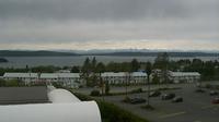
Port McNeill › North
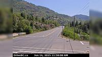
Trail › East: Hwy 3B at Devito Drive, looking east
Vernon › South-West
Explore by Continent
Europe
Asia
South America
Oceania
North America
Africa


Discuss