Live Cams
Countries
Featured Cams
Get A Cam
Live Cams
Countries
Featured Cams
Get A Cam
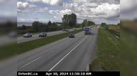
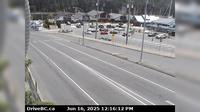
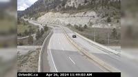
Area C › West: Hwy 20, about 88 km from Bella Coola and 41 km from Anahim Lake, near gate at top of Bella Coola hill, looking west | Live Webcams
Webcam & Weather Report
See.cam
North America
CA
British Columbia
Area C
Area C › West: Hwy 20, about 88 km from Bella Coola and 41 km from Anahim Lake, near gate at top of Bella Coola hill, looking west
Current Still
Timelapse
Daylight Still
Webcam was last updated 2 years ago
Rating
Webcam Views
Map
Discuss
See more webcams in
British Columbia
Surrey › West: Hwy 99, near Hwy 91 around Mud Bay in - looking west on Hwy 99 northbound
Alpine Meadows › South: Hwy 99 at Alpine Way, looking south
Hazelmere › West: Hwy 15 at 16th Ave, looking west
Maple Ridge › South: Hwy 7 (Lougheed Hwy) at 240th St, looking south along 240th St
Nanaimo › East: Hwy 1 at Zorkin Rd/Brechin Rd, looking to Zorkin Road
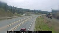
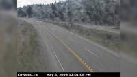
Monte Creek › West: Hwy 1, between - and Pritchard, looking west
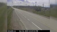
Peace River Regional District › South: Hwy 97 at Beaton Highway, 44 km north of Fort St. John, looking south
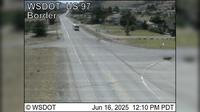
Osoyoos › South: US 97 at MP 336.4: (View South)
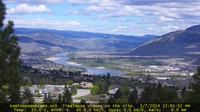
Kamloops › North: Upper Sahali - North Shore - Batchelor Heights
West Kelowna › West: Hwy 97 at Hwy 97C junction, about 5 km south of Westbank, looking west
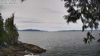
Area A: Koeye
Area D › South: Hwy 97, north of Williams Lake near the turn off to the Bull Mountain ski area, looking south
Explore by Continent
Europe
Asia
South America
Oceania
North America
Africa


Discuss