Live Cams
Countries
Featured Cams
Get A Cam
Live Cams
Countries
Featured Cams
Get A Cam
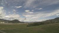
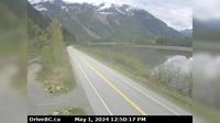
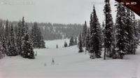
Thompson-Nicola Regional District › North: , Hwy , about km south of Kamloops, looking north | Live Webcams
Webcam & Weather Report
See.cam
North America
CA
British Columbia
Brigade Lake
Thompson-Nicola Regional District › North: , Hwy , about km south of Kamloops, looking north
Current Still
Timelapse
Daylight Still
Webcam was last updated 6 years ago
Rating
Webcam Views
Map
Discuss
See more webcams in
British Columbia
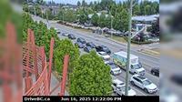
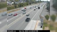
Surrey › North: Hwy 10 at 152 Street, looking north on 152nd
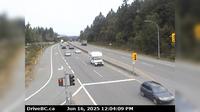
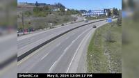
Mill Bay › North: Hwy 1, approximately 3 km south of - looking north
Lake Country: Kelowna Airport - North View
Fort St. James › South: Hwy 27 at Hill St/Greenview in - looking south
Port Edward › East: Hwy 16, next to the Skeena River, about 70 KM east of Prince Rupert, looking east
Quesnel › West: Hwy 97, at Sales Rd, about 10 km south of - looking west
Port Edward › West: Hwy 16 at - arterial road, looking west
Dawson Creek › South: Hwy 97 at Dangerous Goods Route, west of - looking south
Chetwynd › East: Hwy 97 at Wabi Estates Road, east of - looking east
Area A
Saanich › East: Hwy 1 at Tillicum Rd, looking east
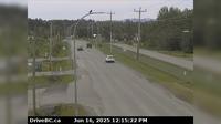
Dufferin 10 › West: Hwy 1 in Kamloops, east of Copperhead Drive, looking west
Explore by Continent
Europe
Asia
South America
Oceania
North America
Africa


Discuss