Live Cams
Countries
Featured Cams
Get A Cam
Live Cams
Countries
Featured Cams
Get A Cam
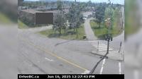
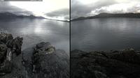
Burns Lake › South: Hwy 35, near Martin Road midway between - and the northern Francois Ferry Landing, looking south | Live Webcams
Webcam & Weather Report
See.cam
North America
CA
British Columbia
Burns Lake
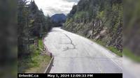
Burns Lake › South: Hwy 35, near Martin Road midway between - and the northern Francois Ferry Landing, looking south
Current Still
Timelapse
Daylight Still
Webcam was last updated 2 years ago
Rating
Webcam Views
Map
Discuss
See more webcams in
British Columbia
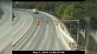
North Kelowna › West: East approach to WR Bennett Bridge at Abbott Street, looking west along Hwy
Area B › South: Hwy 1 at Alexandra Bridge, looking south
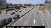
Pitt Meadows › West: Hwy 7 (Lougheed Hwy) at Harris Road, looking west
British Columbia: Calvert Island: West Beach Lookout
Delta › North: Hwy 17A, at Hwy 10 (Ladner Trunk Rd), looking north
Smithers › East: Hwy 16 at Toronto Street in - looking east
Tumbler Ridge › North-West: Hwy 29 at Hwy 52, looking west on Hwy
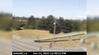
Thompson-Nicola Regional District › North: , Hwy , about km south of Kamloops, looking north
Regional District of Bulkley-Nechako: Burns Lake Airport W
British Columbia: Ethel Island
View Royal
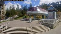
Whistler Resort Municipality: Whistler, bike park
Explore by Continent
Europe
Asia
South America
Oceania
North America
Africa


Discuss