Live Cams
Countries
Featured Cams
Get A Cam
Live Cams
Countries
Featured Cams
Get A Cam
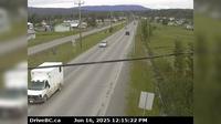
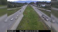
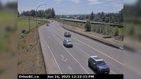
Juan de Fuca Electoral Area › South: Hwy 1 at Okotoks Road, looking south | Live Webcams
Webcam & Weather Report
See.cam
North America
CA
British Columbia
Juan de Fuca Electoral Area
Juan de Fuca Electoral Area › South: Hwy 1 at Okotoks Road, looking south
Current Still
Timelapse
Daylight Still
Webcam was last updated 2 years ago
Rating
Webcam Views
Map
Discuss
See more webcams in
British Columbia
Fort St. James › North: Hwy 27 at Hill St/Greenview in - looking north
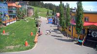
Silver Star Mountain Resort: Silver Star Mountain - Village
Area E
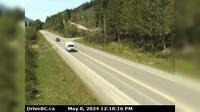
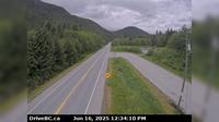
Area F › West: Hwy 18, mid-point between Hwy 1 turn-off and Cowichan Lake exit, looking west
Area C › North
Abbotsford › East: McCallum Road - Trans-Canada Highway
Port Edward › West: Hwy 16, east of Prince Rupert near McNeil River at the Rainbow Summit chain-up area, looking west
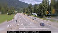
Playmor Junction › North: Hwy 6 at Hwy 3A in - looking north
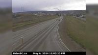
Taylor › South: Hwy 97 at Pine Avenue in - looking south
Courtenay › South: Hwy 19A at 17th Street Bridge in - looking southbound on Comox Rd
Minto Landing: Sandpiper Golf Resort
Area J › North-East: Hwy 97D (Logan Lake/Lac le Jeune Rd) at Hwy 5, looking northeast
Explore by Continent
Europe
Asia
South America
Oceania
North America
Africa


Discuss