Live Cams
Countries
Featured Cams
Get A Cam
Live Cams
Countries
Featured Cams
Get A Cam
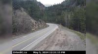
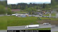
Merritt: Airport, BC | Live Webcams
Webcam & Weather Report
See.cam
North America
CA
British Columbia
Merritt
Merritt: Airport, BC
Current Still
Timelapse
Daylight Still
Webcam was last updated 2 years ago
Rating
Webcam Views
Map
Discuss
See more webcams in
British Columbia
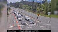
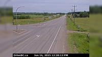
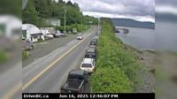
North Cowichan › South: Hwy 1, at Herd Rd/Cowichan Valley Hwy, about 5 km north of Duncan, looking south
Squamish › North: Hwy 99 at - Valley Rd, about 10 km north of - looking north
Surrey › West: Port Kells, at Barnston Ferry Landing, looking west
Area H › East: Hwy 3 near Similkameen Falls, about 6 kms east of Eastgate, looking east
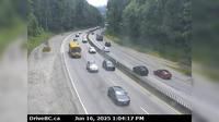
Abbotsford › North: 264 Street - Trans-Canada Highway
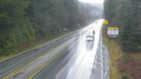
Vancouver › North: Vancouver General Hospital - Fairview - False Creek - South Cambie - Mount Pleasant
Vanderhoof › East: Hwy 16 at Hwy 27 Junction, looking east
Vanderhoof › East: Vanderhoof Airport (CAU4)
Queen Charlotte › North: Hwy 16 at the ferry terminal on Haida Gwaii, looking north
Cedar Village › East: Hwy 1, near Lynn Valley Rd onramp, looking east
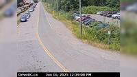
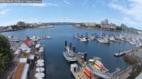
Victoria: Victoria Harbour
Richmond › North
Explore by Continent
Europe
Asia
South America
Oceania
North America
Africa


Discuss