Live Cams
Countries
Featured Cams
Get A Cam
Live Cams
Countries
Featured Cams
Get A Cam
Regional District of Bulkley-Nechako: Burns Lake Airport SE | Live Webcams
Webcam & Weather Report
See.cam
North America
CA
British Columbia
Palling
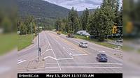
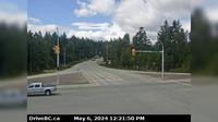
Regional District of Bulkley-Nechako: Burns Lake Airport SE
Current Still
Timelapse
Daylight Still
Webcam was last updated 6 years ago
Rating
Webcam Views
Map
Discuss
See more webcams in
British Columbia
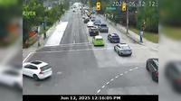
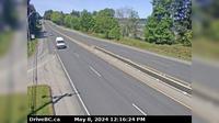
Marpole › North: Oak Street at 70th Avenue, north approach to Oak Street Bridge, looking north on Oak Street
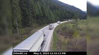
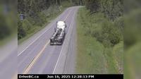
Columbia-Shuswap Regional District › West: , Hwy , about km west of Revelstoke, looking west
Gibsons › North-East: Hwy 101, top of - Bypass at Stewart Rd, looking east
Playmor Junction › North: Hwy 6 at Hwy 3A in - looking north
Area E › North: Hwy 19 at the Nanoose Rest Area, looking north
Witset › North: Hwy 16, in - at Beaver Road, looking north
Saanich › East: Hwy 1, at Admirals Rd - McKenzie Ave, looking east
Bayshores › South-West: Hwy 99 at Bayshore Drive, looking southbound
Area F › West
Area H › West: Hwy 19 at Horne Lake Rd, looking west
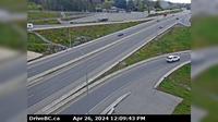
Delta › North-East: Hwy 99 at Hwy 17A overpass, looking north to 62B/River Rd
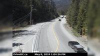
Canal Flats › North: Hwy 93 at Burns Avenue, looking south on Hwy
Explore by Continent
Europe
Asia
South America
Oceania
North America
Africa


Discuss