Live Cams
Countries
Featured Cams
Get A Cam
Live Cams
Countries
Featured Cams
Get A Cam
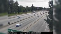
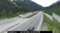
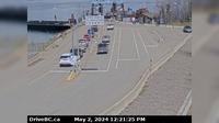
Pitt Meadows › North-West: Pitt River Bridge | Live Webcams
Webcam & Weather Report
See.cam
North America
CA
British Columbia
Pitt Meadows
Pitt Meadows › North-West: Pitt River Bridge
Current Still
Timelapse
Daylight Still
Webcam was last updated 2 years ago
Rating
Webcam Views
Map
Discuss
See more webcams in
British Columbia
Area A › North-West
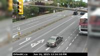
Surrey › South: Hwy 1 at Port Mann Bridge, looking eastbound
Saanich › East: Hwy 17 southbound (Blanshard St) at - Rd, looking east
Kamloops
Haney › North-West: Hwy 7 near River Rd onramp, looking west
Fraser Valley Regional District › North: , Hwy , northbound at Zopkios Rest Area, near the Coquihalla Summit looking north
Area I › East
Maple Ridge › West: Hwy 7 (Lougheed Hwy) at 240th St, looking west along Hwy
Delta › East: Hwy 17 (South Fraser Perimeter Rd), at Hwy 91 Connector, looking east
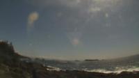
Ucluelet: Amphritite Lighthouse Southeast
Grassy Plains › West: Hwy 35 at Francois Lake Southbank Ferry Landing looking north at ferry ramp
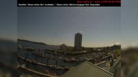
Nanaimo › South-East: NanaimoHarbour
Explore by Continent
Europe
Asia
South America
Oceania
North America
Africa


Discuss