Live Cams
Countries
Featured Cams
Get A Cam
Live Cams
Countries
Featured Cams
Get A Cam
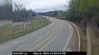
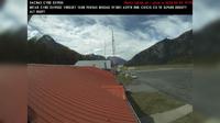
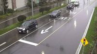
Salmon Arm › South-East: SalmonArm | Live Webcams
Webcam & Weather Report
See.cam
North America
CA
British Columbia
Salmon Arm
Salmon Arm › South-East: SalmonArm
Current Still
Timelapse
Daylight Still
Webcam was last updated 2 years ago
Rating
Webcam Views
Map
Discuss
See more webcams in
British Columbia
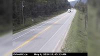
Salmon Valley › South: Hwy 97, north of Prince George at - Rd, looking south
North Vancouver › East: Hwy 1 (Upper Levels Highway) at Lonsdale Ave, looking east
Area A
Abbotsford › East: Clayburn Road - Abbotsford-Mission Highway
Hagensborg › South-West: BellaCoola
Sidney › North: Hwy 17 at McTavish Road, looking north
Surrey › South: Hwy 17 (South Fraser Perimeter Rd) at Bridgeview Dr, looking south
Crawford Bay › North: Hwy 31, 45 km north of Nelson and 25 km south of Kaslo, looking north
Saanich › West: Hwy 17 (Patricia Bay Highway) at Ravine Way, looking west
Area D › North
Malakwa › West: Hwy 1, east of Sicamous at Cambie/Solsqua Roads, looking west
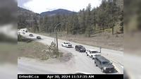
Kaleden › West: Hwy 97 at Hwy 3A junction, just south of - Weigh Scale, looking west
Explore by Continent
Europe
Asia
South America
Oceania
North America
Africa


Discuss