Live Cams
Countries
Featured Cams
Get A Cam
Live Cams
Countries
Featured Cams
Get A Cam
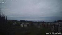
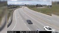
Sandspit › South-East: Airport | Live Webcams
Webcam & Weather Report
See.cam
North America
CA
British Columbia
Sandspit
Sandspit › South-East: Airport
Current Still
Timelapse
Daylight Still
Webcam was last updated 2 years ago
Rating
Webcam Views
Map
Discuss
See more webcams in
British Columbia
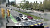
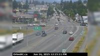
Saanich › West: Hwy 17, Blanshard St at - Rd, looking west
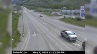
Kamloops › East: Hwy 5 at Halston Ave - Paul Lake Rd in - looking east to Paul Lake Road
Colwood › South-East: Belmont Park - Victoria - Strait of Juan de Fuca
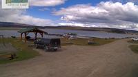
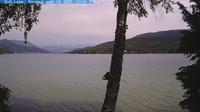
Logan Lake: Tunkwa Lake Resort
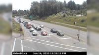
Surrey › South-East: Hwy 17 at 104th Avenue looking southbound
Area A: Gunlake
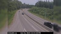
Prince George › East: Hwy 16 at Davis Rd in - looking eastbound
Harrison Hot Springs › West: Hwy 1, near Herrling Island, looking west
Whistler Resort Municipality › South: WhistlerRadar
Delta › South-West: Hwy 17 (South Fraser Perimeter Rd) at 80th Street, looking west
Abbotsford › North: Clearbrook Road - Trans-Canada Highway
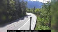
Egmont › South: Hwy 101 at - Rd, south of Earls Cove on the Sunshine Coast, looking South
Explore by Continent
Europe
Asia
South America
Oceania
North America
Africa


Discuss