Live Cams
Countries
Featured Cams
Get A Cam
Live Cams
Countries
Featured Cams
Get A Cam
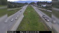
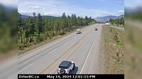
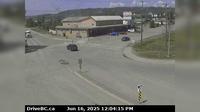
Peace River Regional District › South: Hwy 97 at Beaton Highway, 44 km north of Fort St. John, looking south | Live Webcams
Webcam & Weather Report
See.cam
North America
CA
British Columbia
Taylor
Peace River Regional District › South: Hwy 97 at Beaton Highway, 44 km north of Fort St. John, looking south
Current Still
Timelapse
Daylight Still
Webcam was last updated 2 years ago
Rating
Webcam Views
Map
Discuss
See more webcams in
British Columbia
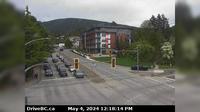
Courtenay › West: Hwy 19A at Ryan Road in - looking westbound
Smithers › East: Hwy 16 at Toronto Street in - looking east
Abbotsford › East: McCallum Road - Trans-Canada Highway
Castlegar
Monte Creek › North: Hwy 97 at the - brake check, looking north
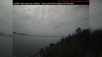
Southern Gulf Islands Electoral Area › South-West: SaturnaIsland-EastPoint
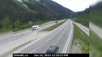
Fraser Valley Regional District › North: , Hwy , northbound at Zopkios Rest Area, near the Coquihalla Summit looking north
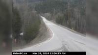
Salmo › North: Hwy 3 at Hwy 3B junction looking westbound
Taylor › West: Hwy 97 at Pine Avenue in - looking west
Gyro › North: Hwy 6 near Hwy 3A and Rosemont/Uphill interchange, looking north
Chilliwack › West: Hwy 1 at Evans Road overpass near - looking west
North Vancouver › North: Hwy 1 (Upper Levels Highway) at Lonsdale Ave, looking north
Explore by Continent
Europe
Asia
South America
Oceania
North America
Africa


Discuss