Live Cams
Countries
Featured Cams
Get A Cam
Live Cams
Countries
Featured Cams
Get A Cam
Vanderhoof › East: Vanderhoof Airport (CAU4) | Live Webcams
Webcam & Weather Report
See.cam
North America
CA
British Columbia
Vanderhoof
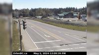
Vanderhoof › East: Vanderhoof Airport (CAU4)
Current Still
Timelapse
Daylight Still
Webcam was last updated 2 years ago
Rating
Webcam Views
Map
Discuss
See more webcams in
British Columbia
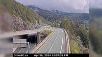
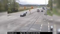
West Vancouver › East: Hwy 99 at Hwy 1 ramp to Horseshoe Bay, looking east
Hilliers › North: Hwy 4 at Alberni Hwy (Hwy 4A) junction, about 2 km west of Coombs, looking north
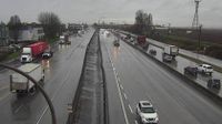
Delta › West: Hwy 91 at Fraserwood Way, on the East-West Connector, looking west
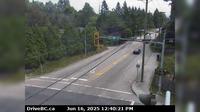
Haney › East: Hwy 7 (Lougheed Hwy) at - Bypass/222nd Street, looking west
Grandview › East: Hwy 15 at 24th Ave, looking east
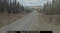
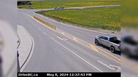
Topley › West: On Hwy 16, 39 km west of Burns Lake looking west
Pemberton › South: Hwy 99 at Portage Rd in - looking south
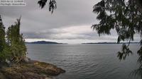
British Columbia: Koeye River Mouth
Salmon Arm: Airport, BC
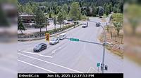
Abbotsford › South: Hwy 11 at Clayburn Road, looking south
Salmon Arm › South: Hwy 1 at 30th Street SW in - looking south
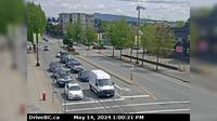
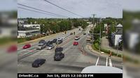
City of Langley › North: Hwy 10 at 200 Street in Langley, looking north
Explore by Continent
Europe
Asia
South America
Oceania
North America
Africa


Discuss