Live Cams
Countries
Featured Cams
Get A Cam
Live Cams
Countries
Featured Cams
Get A Cam
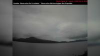
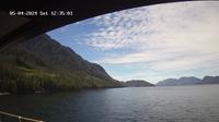
Area B: Gabriola Ferry Cam | Live Webcams
Webcam & Weather Report
See.cam
North America
CA
British Columbia
Area B
Area B: Gabriola Ferry Cam
Current Still
Timelapse
Daylight Still
Webcam was last updated 2 years ago
Rating
Webcam Views
Map
Discuss
See more webcams in
British Columbia
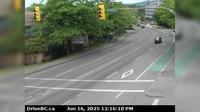
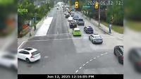
Surrey › South: Pacific Crossing at 2nd Avenue, looking south
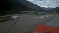
Nelson › North-East: Airport
Hilliers › East: Hwy 4 at Alberni Hwy (Hwy 4A) junction, about 2 km west of Coombs, looking east
Terrace › West: Northwest Regional Airport
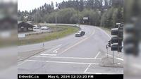
Metchosin › West: Hwy 14 at Kangaroo Rd, looking west
Saanich › North: Hwy 17 northbound at - Rd, looking north
Area A › North-West: AddenbrokeIslandLightstation
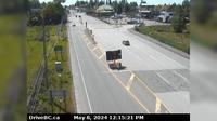
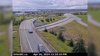
Delta › South: Hwy 17 (South Fraser Perimeter Rd) at Deltaport Way in South - looking south
Area E › North-East
Marpole › North: Oak Street at 70th Avenue, north approach to Oak Street Bridge, looking north on Oak Street
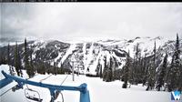
Area C: Calypso camp: Calypso Camp
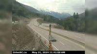
Golden › East: Hwy 1 (Kicking Horse Canyon) at 10 Mile Brake Check, looking east
Explore by Continent
Europe
Asia
South America
Oceania
North America
Africa


Discuss