Live Cams
Countries
Featured Cams
Get A Cam
Live Cams
Countries
Featured Cams
Get A Cam
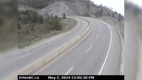
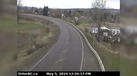
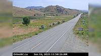
Regional District of Fraser-Fort George › West: Hwy , about km west of McBride at Loos Rd, looking west | Live Webcams
Webcam & Weather Report
See.cam
North America
CA
British Columbia
Dome Creek
Regional District of Fraser-Fort George › West: Hwy , about km west of McBride at Loos Rd, looking west
Current Still
Timelapse
Daylight Still
Webcam was last updated 6 years ago
Rating
Webcam Views
Map
Discuss
See more webcams in
British Columbia
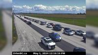
Delta › East: Hwy 17 at 56<sup>th</sup> St., looking east
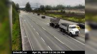
West Heights › East: Lougheed Hwy (Hwy 7) at Nelson St in Mission, looking east
West Kelowna › East: Hwy 97 at Hwy 97C junction, about 5 km south of Westbank, looking east
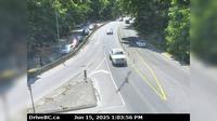
Langford › South: Hwy 1, in Goldstream Park at Finlayson Arm Rd, looking south
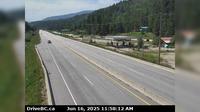
Houston › East: Hwy 16 at Butler Avenue in - looking east
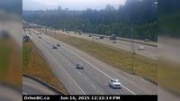
Surrey › East: Hwy 1 at 176th Street overpass, looking east
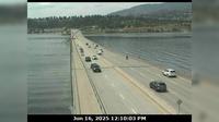
Kelowna › West: East end of WR Bennett Bridge connecting - and West - looking west
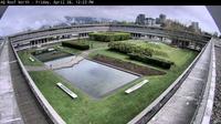
Burnaby › North-East: Academic Quadrangle
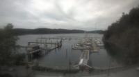
Southern Gulf Islands Electoral Area: Bedwell Harbour Marina
Oliver › East: Hwy 3 next to Conifryd Lake, looking east
Columbia-Shuswap Regional District › West: , Hwy near Perry River Bridge, about km east of Sicamous, looking west
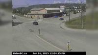
Taylor › West: Hwy 97 at Pine Avenue in - looking west
Explore by Continent
Europe
Asia
South America
Oceania
North America
Africa


Discuss