Live Cams
Countries
Featured Cams
Get A Cam
Live Cams
Countries
Featured Cams
Get A Cam
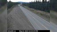
Field › South-West: Hwy 1 at - Access Road, about 16 km west of BC/Alberta border, looking southwest | Live Webcams
Webcam & Weather Report
See.cam
North America
CA
British Columbia
Field
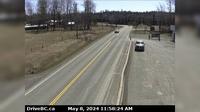
Field › South-West: Hwy 1 at - Access Road, about 16 km west of BC/Alberta border, looking southwest
Current Still
Timelapse
Daylight Still
Webcam was last updated 3 years ago
Rating
Webcam Views
Map
Discuss
See more webcams in
British Columbia
Anniedale › North: Golden Ears Way at 96 Avenue Connector, looking south
Nelson › North: Hwy 6, at Whitewater Ski Hill Rd about 12.5 km south of - looking north
Clinton › North: Hwy 97, 8 km north of - just before Big Bar rest area, looking north
Surrey › West: Hwy 99, near Hwy 91 around Mud Bay in - looking west on Hwy 99 northbound
Pitt Meadows › North: Hwy 7 (Lougheed Hwy) at Dewdney Trunk Rd, looking north
Pemberton › West: Hwy 99 at Portage Rd in - looking west
Interlakes › East: Hwy 24, 63 km west of Little Fort, looking east
Oak Bay › North-East
Burns Lake › South: Hwy 35, near Martin Road midway between - and the northern Francois Ferry Landing, looking south
Nanaimo › North: Hwy 1 at Zorkin Rd/Brechin Rd, looking at Departure Bay Ferry Terminal
Central Coast Regional District: Addenbroke Island Lightstation Webcam
Merritt: Airport, BC
Explore by Continent
Europe
Asia
South America
Oceania
North America
Africa

Discuss