Live Cams
Countries
Featured Cams
Get A Cam
Live Cams
Countries
Featured Cams
Get A Cam
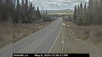
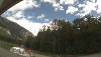
Hagensborg › North-East: Bella Coola Airport NE | Live Webcams
Webcam & Weather Report
See.cam
North America
CA
British Columbia
Hagensborg
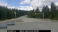
Hagensborg › North-East: Bella Coola Airport NE
Current Still
Timelapse
Daylight Still
Webcam was last updated 2 years ago
Rating
Webcam Views
Map
Discuss
See more webcams in
British Columbia
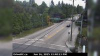
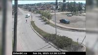
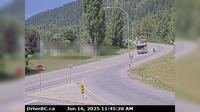
Topley › West: On Hwy 16, 39 km west of Burns Lake looking west
Grandview › East: Hwy 15 at 24th Ave, looking east
Smithers › East: Hwy 16 in - at Main Street, looking east
Mission › West: Hwy 7 at Hwy 11 approaching - looking west
Salmo › West: Hwy 3 at Hwy 6, looking west on Hwy
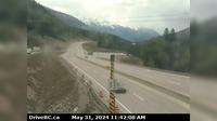
Golden › East: Hwy 1 (Kicking Horse Canyon) at 10 Mile Brake Check, looking east
Columbia-Shuswap Regional District › West: , Hwy , about km north of Golden at Donald Bridge, looking west
Hagensborg › North-East: Bella Coola Airport NE
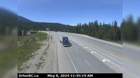
Summit Lake › North: Hwy 97 at - Rd, about 48.5 km north of Prince George, looking north
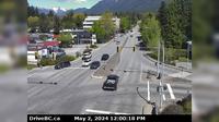
District of North Vancouver › North: Hwy 1 (Upper Levels Highway) at Westview Dr. looking north
Area H › West: Hwy 19 at Horne Lake Rd, looking west
Delta › East: Hwy 91 Connector at Nordel Way, looking east
Explore by Continent
Europe
Asia
South America
Oceania
North America
Africa


Discuss