Live Cams
Countries
Featured Cams
Get A Cam
Live Cams
Countries
Featured Cams
Get A Cam
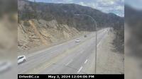
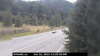
Peace River Regional District › East: Hwy , km west of BC/Alberta border, looking east | Live Webcams
Webcam & Weather Report
See.cam
North America
CA
British Columbia
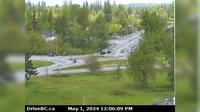
Kelly Lake
Peace River Regional District › East: Hwy , km west of BC/Alberta border, looking east
Current Still
Timelapse
Daylight Still
Webcam was last updated 6 years ago
Rating
Webcam Views
Map
Discuss
See more webcams in
British Columbia
Nanaimo › North: Hwy 19 at Northfield Rd in - looking north
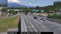
Township of Langley › North: Hwy 1 westbound on-ramp from 232nd St, looking north
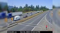
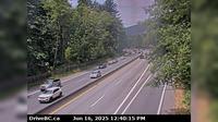
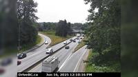
Hope 1 › North-East: Hwy 7, about 2 km west of Hope, looking eastbound
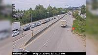
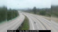
Surrey › West: Hwy 17 (South Fraser Perimeter Rd) at Bridgeview Dr, looking west
Chilliwack › North: Evans Road overpass at Hwy 1 near - looking north
West Vancouver › West: Hwy 1 at Hadden Drive ramp for Taylor Way, looking west
Delta › North: Hwy 91 at 72<sup>nd</sup> Ave. in - looking north
Fraser Valley Regional District › North: , Hwy , km south of Merritt, looking north
West Lynn › South: Hwy 1, northend of Ironworkers Memorial Bridge at Fern Street, looking southbound
Boothroyd 8A › South: Hwy 1 at Kahmoose Rd in Boothroyd, 12 km north of Boston Bar, looking south
Area C
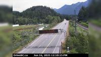
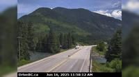
Columbia-Shuswap Regional District › East: , Hwy near the Perry River Bridge, about km east of Sicamous, looking east
Explore by Continent
Europe
Asia
South America
Oceania
North America
Africa


Discuss