Live Cams
Countries
Featured Cams
Get A Cam
Live Cams
Countries
Featured Cams
Get A Cam
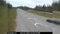
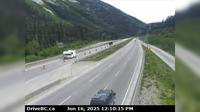
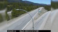
Peachland › East: Hwy 97C (Okanagan Connector), about 22km west of 97/97C Jct, looking east | Live Webcams
Webcam & Weather Report
See.cam
North America
CA
British Columbia
Peachland
Peachland › East: Hwy 97C (Okanagan Connector), about 22km west of 97/97C Jct, looking east
Current Still
Timelapse
Daylight Still
Webcam was last updated 2 years ago
Rating
Webcam Views
Map
Discuss
See more webcams in
British Columbia
Fraser Lake › West: Hwy 16, at Nautley Road, looking west
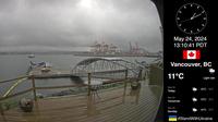
Vancouver › North-East: Burrard Inlet
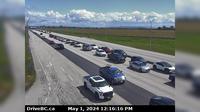
Delta › East: Hwy 17 at 56<sup>th</sup> St., looking east
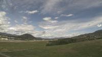
Lake Country: Kelowna Airport - North View
Area A › North-West: Klinaklini Glacier
Pacific Sands Beach
Fraser Valley Regional District › North: , Hwy , northbound at Zopkios Rest Area, near the Coquihalla Summit looking north
Pemberton › West
Sparwood › North: Hwy 43, between - and Elkford at Line Creek Mine Rd., looking north
Gibsons › North: Hwy 101, top of - Bypass at Stewart Rd, looking north
Area B
Fraser Valley Regional District › North: , Hwy , by Britton Creek Rest Area northbound turnoff, looking north
Explore by Continent
Europe
Asia
South America
Oceania
North America
Africa


Discuss