Live Cams
Countries
Featured Cams
Get A Cam
Live Cams
Countries
Featured Cams
Get A Cam
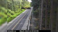
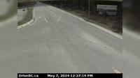
Regional District of Bulkley-Nechako › East: Hwy , about km east of Burns Lake, looking east | Live Webcams
Webcam & Weather Report
See.cam
North America
CA
British Columbia
Sheraton
Regional District of Bulkley-Nechako › East: Hwy , about km east of Burns Lake, looking east
Current Still
Timelapse
Daylight Still
Webcam was last updated 6 years ago
Rating
Webcam Views
Map
Discuss
See more webcams in
British Columbia
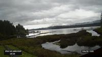
Area D › East: Sproat Lake Landing Resort
Area C › East: Hwy 19 near Hyde Creek Rd, 4.5km south of Port McNeill, looking east
Nanaimo › South-East: Hwy 1 at Zorkin Rd/Brechin Rd, looking to Stewart Avenue
Salmon Arm › West: Hwy 1 at Annis Pit, 8 km southwest of Sicamous, looking west
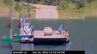
Area K › North: Hwy 6 at South Arrow Park Ferry Terminal, 22km south of Nakusp at junction of Upper and Lower Arrow Lakes, looking at north landing
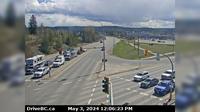
Prince George › East: Hwy 97 at Hwy 16 in - looking southbound on Hwy
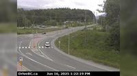
Area E › South: Hwy 16 at Hwy 37S near Terrace, looking south
Canoe Cove
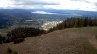
East Central Okanagan Electoral Area › South-West
Cedarvale › East: Junction of Hwy 16 and Hwy 37, near Kitwanga, looking east on Hwy
Area C › North-East
Harrison Hot Springs › East: Hwy 1, near Herrling Island, looking east
Explore by Continent
Europe
Asia
South America
Oceania
North America
Africa


Discuss