Live Cams
Countries
Featured Cams
Get A Cam
Live Cams
Countries
Featured Cams
Get A Cam
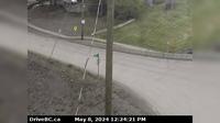
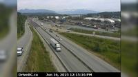
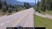
Thompson-Nicola Regional District › North: , Hwy at Larson Hill, km south of Merritt, looking north | Live Webcams
Webcam & Weather Report
See.cam
North America
CA
British Columbia
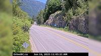
Coquihalla
Thompson-Nicola Regional District › North: , Hwy at Larson Hill, km south of Merritt, looking north
Current Still
Timelapse
Daylight Still
Webcam was last updated 6 years ago
Rating
Webcam Views
Map
Discuss
See more webcams in
British Columbia
Telkwa › East: Hwy 16, in - at Hankin Rd, looking east
Gyro › North: Hwy 6 near Hwy 3A and Rosemont/Uphill interchange, looking north
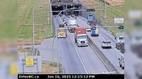
Chilliwack › West: Hwy 1 at Prest Rd in - looking west
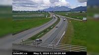
Delta › North: Hwy 99 from north of Hwy 17A overpass, looking north
New Westminster › East: Hwy 17 (South Fraser Perimeter Rd) at Tannery Rd Overpass in Surrey, looking east
Hagensborg › North-East: Bella Coola Airport NE
Langford › West: Hwy 14 (Veteran's Memorial Parkway) at Goldstream Ave in - looking west
Lake Country › South: Hwy 97, in - by Wood Lake, looking south
Playmor Junction › South: Hwy 6 at Hwy 3A in - looking south
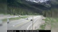
Jumbo Glacier Mountain Resort Municipality › East: Hwy 1, Rogers Pass in Glacier National Park, 72 km east of Revelstoke, looking east
Haney › North: Westbound on Lougheed Highway at Kanaka Way - Bypass
Pitt Meadows › South: Hwy 7 (Lougheed Hwy) at Harris Road, looking south
Explore by Continent
Europe
Asia
South America
Oceania
North America
Africa


Discuss