Live Cams
Countries
Featured Cams
Get A Cam
Live Cams
Countries
Featured Cams
Get A Cam
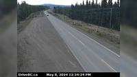
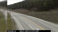
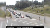
Mackenzie › East: Hwy 97 at Hwy 39, about 29 km south of - looking east | Live Webcams
Webcam & Weather Report
See.cam
North America
CA
British Columbia
Mackenzie
Mackenzie › East: Hwy 97 at Hwy 39, about 29 km south of - looking east
Current Still
Timelapse
Daylight Still
Webcam was last updated 2 years ago
Rating
Webcam Views
Map
Discuss
See more webcams in
British Columbia
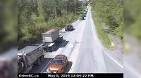
Burns Lake › South: Hwy 35, near Martin Road midway between - and the northern Francois Ferry Landing, looking south
Hazelmere › West: Hwy 15 at 16th Ave, looking west
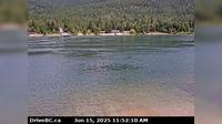
Harrop › North: Ferry Landing on the south side of Kootenay Lake, looking north
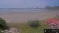
Area C: Long Beach Lodge Resort
Surrey › North: Pacific Crossing at the border, looking north
Soda Creek › West: Hwy 97 and Beaver Lake Rd junction north of McLeese Lake, looking west
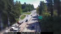
District of North Vancouver › East: Hwy 1 (Upper Levels Highway) at Capilano Rd. looking east
Pacific Sands Beach
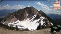
Golden: Terminator Peak
Surrey › South-East: Hwy 17 at 104th Avenue looking southbound
Halfmoon Bay › South: Hwy 101 at Brooks Rd on the Sunshine Coast, looking south
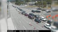
Delta › North-East: Hwy 99 at Hwy 17A overpass, looking north to 62B/River Rd
Explore by Continent
Europe
Asia
South America
Oceania
North America
Africa


Discuss