Live Cams
Countries
Featured Cams
Get A Cam
Live Cams
Countries
Featured Cams
Get A Cam
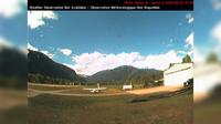
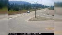
Burns Lake › North: Hwy 35, near Martin Road midway between - and the northern Francois Ferry Landing, looking north | Live Webcams
Webcam & Weather Report
See.cam
North America
CA
British Columbia
Burns Lake
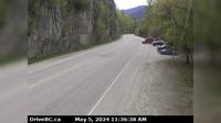
Burns Lake › North: Hwy 35, near Martin Road midway between - and the northern Francois Ferry Landing, looking north
Current Still
Timelapse
Daylight Still
Webcam was last updated 2 years ago
Rating
Webcam Views
Map
Discuss
See more webcams in
British Columbia
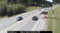
Pemberton › West
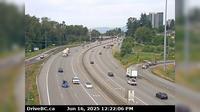
New Westminster › West: Hwy 1 in Coquitlam, west of the Brunette Ave overpass, looking west
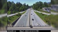
District of North Vancouver › West: Hwy 1 (Upper Levels Highway) at Westview Dr. looking west
Gold River › West
Elko › South: Hwy 3, about 1 km west of - at Hwy 93 junction, looking south
Elko › West: Hwy 3, about 1 km west of - at Hwy 93 junction, looking west
Abbotsford › North
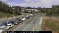
Surrey › West: Hwy 15 at 8th Avenue, in South - looking west
Langford › North: Hwy 1 at the Millstream Interchange, looking north
Hilliers › West: Hwy 4 at Alberni Hwy (Hwy 4A) junction, about 2 km west of Coombs, looking west
Area C
Nelson › South: Hwy 6 near Hwy 3A and Rosemont/Uphill interchange, looking south
Explore by Continent
Europe
Asia
South America
Oceania
North America
Africa


Discuss